The completion of the first day of the Pinhoti Trail Adventure Run was made possible through extensive training. Day two of PTAR was all about pain management.
Sitting on the curb like school children waiting for the bus, Rob (Youngren) and I sat outside of the Super 8 in Sylacauga awaiting Josh’s (Kennedy) arrival. We were all packed up and ready to roll in the pre-dawn hours, ready to get back at it after a less than restful 6 hours of sleep. Finally Josh rolled in and we split our gear between his Xterra and Rob’s Mercedes, which would arrive later in the day when Kathy (Youngren), Blake (Thompson) and Sarah (Bowden) would assume the role of the second crew.
After an endless drive back to Porter’s Gap, we began to gear up for the first section of the run. At less than three miles to the first aid point, I grabbed just a hand bottle and shoved an oatmeal creme pie down as pre-run fuel. I dawned the rest of my running gear, including my inov-8 roclite 305’s and two Pro-Tec Athletics Patellar Tendon Straps to ease the pain of my runner’s knee.
The first 15 miles of running on this day is the same as the first half of the Mount Cheaha 50km that I had run just two months prior. Then the following 12 miles to Mount Cheaha State Park continued to climb to the top of Alabama near 2.400' of elevation. The day after the 50km in February, Eric Fritz and I had run the 12 mile section, so I was fully aware of the difficulty that this day would present.
As hastily as I had packed my gear, I realized within the first few minutes of running that I had forgotten to take any Tylenol. Luckily Rob had some packed with him so I took two right away. Not a good sign of things to come. We continued to run a decent pace through the first 2.7 miles where we reached Skyline Drive and walked down the gravel road across the river and rail road tracks where we met up with Josh and our good friend and day 2 pacer John Nevels.

From there, we had about a 7 mile section to Clairmont Gap where we would see Josh again. This section of trail was fairly uneventful and slow. John brought us up to speed on what was going on in the world of running with Chris Solinky's 10km record and the fast times at Miwok 100km. Being on the trail all day and preparing for the following day all night leave little time to catch up on newsworthy events that we would otherwise see on Facebook or Twitter.
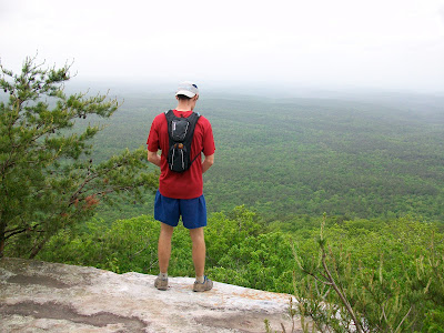
Here we are coming out of the woods at Clairmont Gap in a photo taken by Josh.

Leaving Clairmont Gap, we had a 6 mile section to Adams Gap in which we would parallel the Talledega Scenic Highway, which is actually no more than an impassable jeep road. We were still just on hand bottles and wouldn't need the packs until later in the day. The trail immediately climbs up a steep hill that had us walking, just as I had done in the 50km race. After that, the 'Rock Garden' and slope of the trail from right to left meant much, much more walking. Honestly we were never really able to string together much of a running rhythm through the following miles based on the terrain. My knees where bothering me and I was ready for some more pain relief so when we rolled into Adams Gap at mile 15, I was ready to sit down. When I say sit down, I actually mean lay down. After I assembled my pack and slammed a Boost, I laid down on the pavement of Adams Gap Road and took off my shoes. I was beginning to get hot spots on the middle of my forefoot of each foot and I sensed that blisters would soon form under my callouses. Here we are seen just coming into Adams Gap at the Silent Trail crossing.

If we were wearing our 'suck-o-meter' shirts, the needle would be pegged on 'sucks-worse' during the next few hours until we made it to the State Park. The climb up Stairway to Heaven was just as I remembered it; nothing short of a bitch - a winding trail that switch-backed up 900' over 4 miles crossing large rocks covered in moss that didn't even closely resemble a trail. We hiked our way up to the 2000' mark where there was the first decent overlook of the day. We all sat down and when I say sat down, I really mean collapsed. I think that we were all pretty low on fuel, having not consumed enough today compared to the energy required to make this climb. I don't remember taking or having this picture taken, but it sums up how I was feeling at the 20 mile mark.

Continuing on along after a 5 minute rest where we re-fueled with string cheese and Boost, we climbed another 200' before reaching the top of the ridge line. We would remain along the ridge for another few miles actually making pretty good time. We still had not seen a single person along the trail which was very surprising given that it was a Sunday. The winds atop the ridge seemed to cut down on the humidity. The forecast had called for rain for two consecutive days now but we had not seen a single drop of rain.
We had one more significant stop along the way where we took off our packs and and sat down to eat. John entertained us by declaring the world's highest urine drop as he 'went' over the edge of the cliff. He joked that he was done 'going' before it ever reached the bottom. This seemed to lift our spirits as we strapped on the packs and moved forward.
One of the things I remember about the entire trip was that often times there would be a perfectly passable gravel or jeep road for us to run on, but the trail would only cross it, many times and run adjacent in the woods. Near the 23 mile mark, we would veer off of the road and onto a narrow and rocky trail. I couldn't remember the purpose of this side jaunt, until we reached the summit. At the overlook was a large Pinhoti Trail sign that marked the mileage along the way, including points at the Benton MacKaye Trail head and along the entire Appalachian Trail. We stopped for just a minute for a photo opportunity.

The next major memory from the first 27 mile section on this day was trying to remember where I had placed the 'heart-rock' on my previous visit with Eric Fritz. For those of you who don't know me, I have a long history of trying to find a heart shaped rock and then writing the location and date on it for my wife Laura. She has rocks from all over the country in a collection she has been building from me since 1998. Typically these rocks are very small and weigh less than an ounce. The rock that I found in February was about 12" across. 2" deep and weighed about 10 pounds. I had told Eric Fritz, then Rob and John that each time I visited the trail, I would carry the rock a little bit further and eventually it would reach the road where I could pick it up with the car and give it to Laura. Well after sprinting ahead up a steep climb to allow myself enough time to look around, I found it within seconds. So I proceeded to pick it up and carry it on our run. we had about 2 miles to go before the road crossing and for some reason I was determined to carry it all the way our and to not let is slow our progress. So I carried it with two hands in front of me, under one arm, then the other and a variety of ways that seemed to amuse Rob. It was just the comic relief that we needed. Upon meeting our crew at the trail head (who were surprisingly joined by friend David Riddle), I was carrying it in front of me with two hands and it looked like my heart... they knew right away what it meant and laughed.
The first 27 miles on this day took us about 8 hours to complete and our plan for the day was 48 miles so we had another 21 miles to cover with just 5 or so hours of daylight to go. When describing this day to Eric Fritz later on, I told him the distance and the time and followed it up by saying, "and then the trail got harder." It didn't get technically harder, but after the grueling morning, a walk in the park would have been challenging.
After strapping on the packs at the road crossing, we were ready to roll out on the next section of the trail. David Riddle, wearing his road shoes, decided that the best way to keep his 3 1/2 year running streak (averaging 11 miles a day) in tact was to run with us. The three of us left before he was ready, joking about how we were going to drop him... yeah right! He caught up within a matter of minutes. Together, Rob lead us out on the trail in a running pace. Luckily he was not moving too quickly, so David and I were able to use our long legs as an advantage and just walk briskly to keep up. David would often sprint ahead with the camera and then wait for us to pass by to snap some pictures. This one was my absolute favorite, as David stood on a 4' tall tree stump to capture shots as we ran by.

The next few miles we actually picked up the pace as Rob and David started to stride out a little faster on some very nice and non-technical trail. I remember that John and I would fall back (or I would fall back and John would stay with me) and then I would charge on the up hills to close the gap. My feet were really hurting me now and running downhill made it even worse. This was a very long 8-10 mile stretch that was very taxing on me. I was having trouble with my pain management and struggling to keep up. When we finally made it to the Hillabee Creek I took off my shoes and soaked my whole body in the icy creek, as did Rob. I could have stayed there all afternoon, but we had many more miles to go on this day.
Not long before our crew met us at Cleburn County Road 24, we came across the infamous rusted-out van in the woods that most ultra-runners of the area know about. We stopped for a picture which brought a smile to my face for a little while. I managed to climb up on top which was sort of scary as the rust of the beams was about to break apart, but it made the picture all the more memorable. Here I am saying, "look, no hands!"

From CR 24 to US-431, Rob was a man on a mission. He set the pace and it was very aggressive. For awhile we were running under 9 minute-mile pace, which was twice as fast as we had run all day. Rob was thinking ahead, knowing that we were running out of daylight and still had another 10 miles to cover from CR to I-20 and we did not want to fall off our daily schedule, nor did we want to run for too long in the dark. Rob's crazy pace paid off as we hit 431 at about 7:00 pm with only 5 miles to go.
At US-431 John had to call it quits for the day so he could get back to Auburn. We were very thankful to have him for the 40 miles he joined us on, especially through the Stairway to Heaven section. Rob, David and I grabbed our headlamps and set back out for the last section to I-20. Rob and I are experienced night/trail runners and quickly our eyes adapted to the onset of darkness. David had never run with a headlamp before, or at night, so I gave him mine and I carried Rob's back up, which was very, very dim. Yet we delayed turning them on until the last possible shred of light had left the dense forest. The ironic part was that with just a couple of miles left, I stopped and said that I heard something in the woods, so Rob and David stopped too. I could not figure out what it was, so we took a few steps forward and with a stroke of luck, Rob was able to spot a fairly large rat snake. He gently moved it off of the trail and then we joked about the Indiana Jones line from Raiders of the Lost Ark when he says, "Snakes... why did it have to be snakes!" After that, we turned on the headlamps and kept moving.
Finally locating a glimmer of light at the top of a hill climb, we realized that we were emerging from the woods and it was Matthew with a headlamp, waiting to direct us to the north and over I-20 to our final stop for the day. Just as we finished and started to de-robe and pack up the gear on the side of the road, it began to rain steadily. We moved fast and packed into the Xterra and headed into Hefflin, AL where we would spend the night.
What I will remember most about day 2 was how difficult the first 27 miles were and how all day long I was focusing on managing the pain I felt in my knees and my now blistered feet. There were plenty of smiles and plenty of grimaces but I stayed with it, completing my first 100 miler in under 38 hours.
I will remember being witness to the first time that David Riddle had run for longer than 4 hours (in training or in a race), having completed several 50km races in less time than that. But most of all, I will remember the friendships that had been forged long ago that were strengthened on this day between four ultra runners suffering through the pain together.
Stats
End Time: 20:09:31
Total Time Running: 14 hours 11 minutes 47 seconds
Total Distance: 48.7 miles
Elevation Change: 7,854' of elevation climb and 7,791' of elevation drop for 15,645' of elevation change.
PTAR Day 2 part 1 (GPS A): 6,404' of elevation climb and 6,651' of elevation drop
PTAR Day 2 part 2 (GPS B): 1,450' of elevation climb and 1,140' of elevation drop